Rescuing the SDGs with Geospatial Data
UN Background Document, UN-WGGI IAEG-SDGs, 2025
geospatial data science consultant
visiting lecturer at paris dauphine université - master peace studies
I’m passionate about how the techniques and discourses from territory focused disciplines can be re-appropriated through the use of information systems and data science.
I do freelance work on geospatial projects, having an extensive experience working with spatial analysis and cartography for humanitarian institutions like the UN Sustainable Development Solutions Network, World Resources Institute, Translators Without Borders, UNDP, UNEP and the World Bank. In past positions I've developed solutions for automating processes involving remote sensing and spatial analysis in humanitarian crises contexts through the use of GIS software and programming with python and javascript using frameworks like google earth engine, geopandas, postgis/geoserver and arcgis online. I've collaborated in environmental and spatial related research projects developed at TU-Delft, UNESCO-IHE, Oxford-Brookes University, McGill University, Ecole d'Urbanisme de Paris and Universidade Federal do Rio Grande do Sul on the subjects of Geodesign for Nature Based Solutions, Urban Metabolism, Circular Economy, Scaling Laws and Road Ecology. I'm a teacher to the "Data, conflicts and disasters" discipline at Paris Dauphine University.
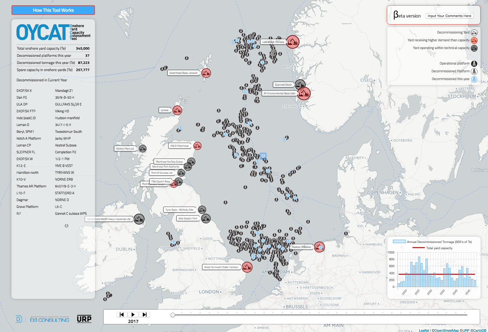
UN Background Document, UN-WGGI IAEG-SDGs, 2025
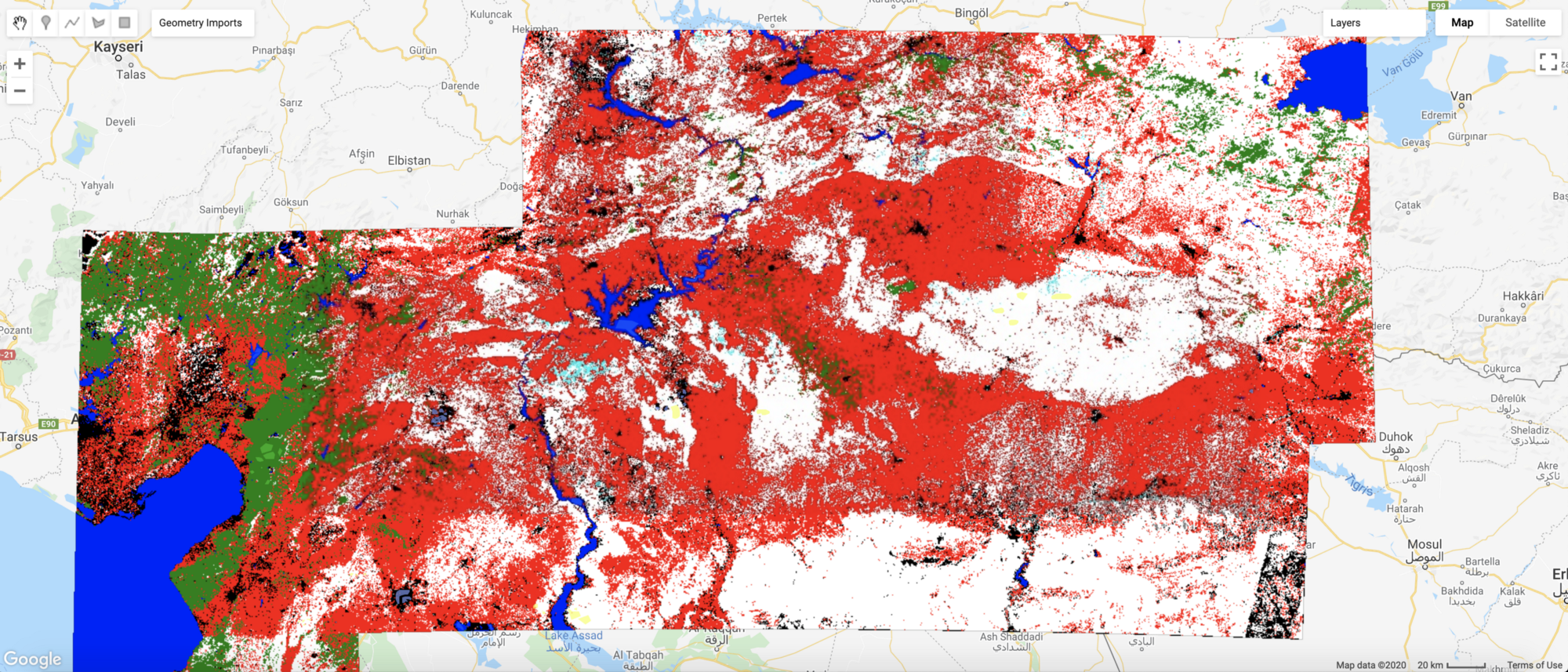
Accelerator program for Damage Detection through inSAR, NASA, 2025
Machine learning, UN SDSN, 2024
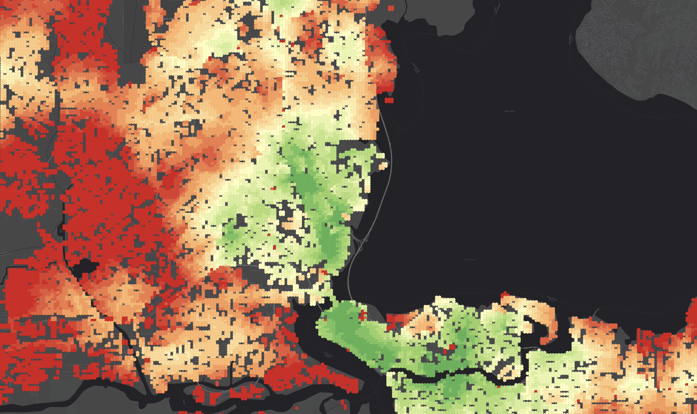
Radar remote sensing for Urban Stock Assessment, WRI, 2024
Research paper in remote sensing and industrial ecology, UN SDSN, 2024
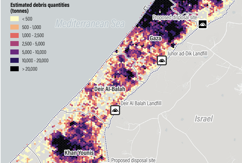
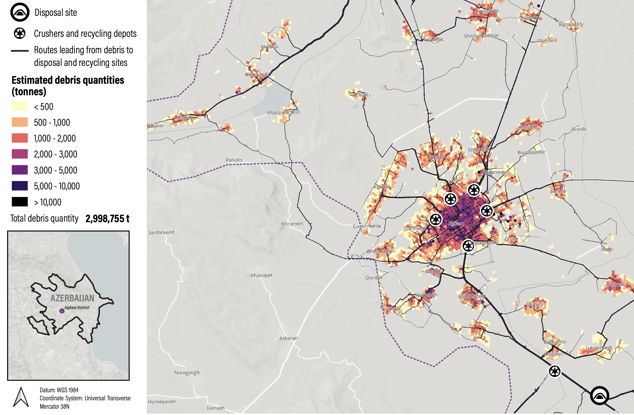
Remote sensing for Debris assessment, UN Environment, 2024
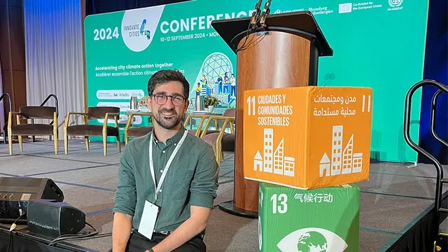
Conference, UN Habitat, Global Covenant of Mayors, 2024
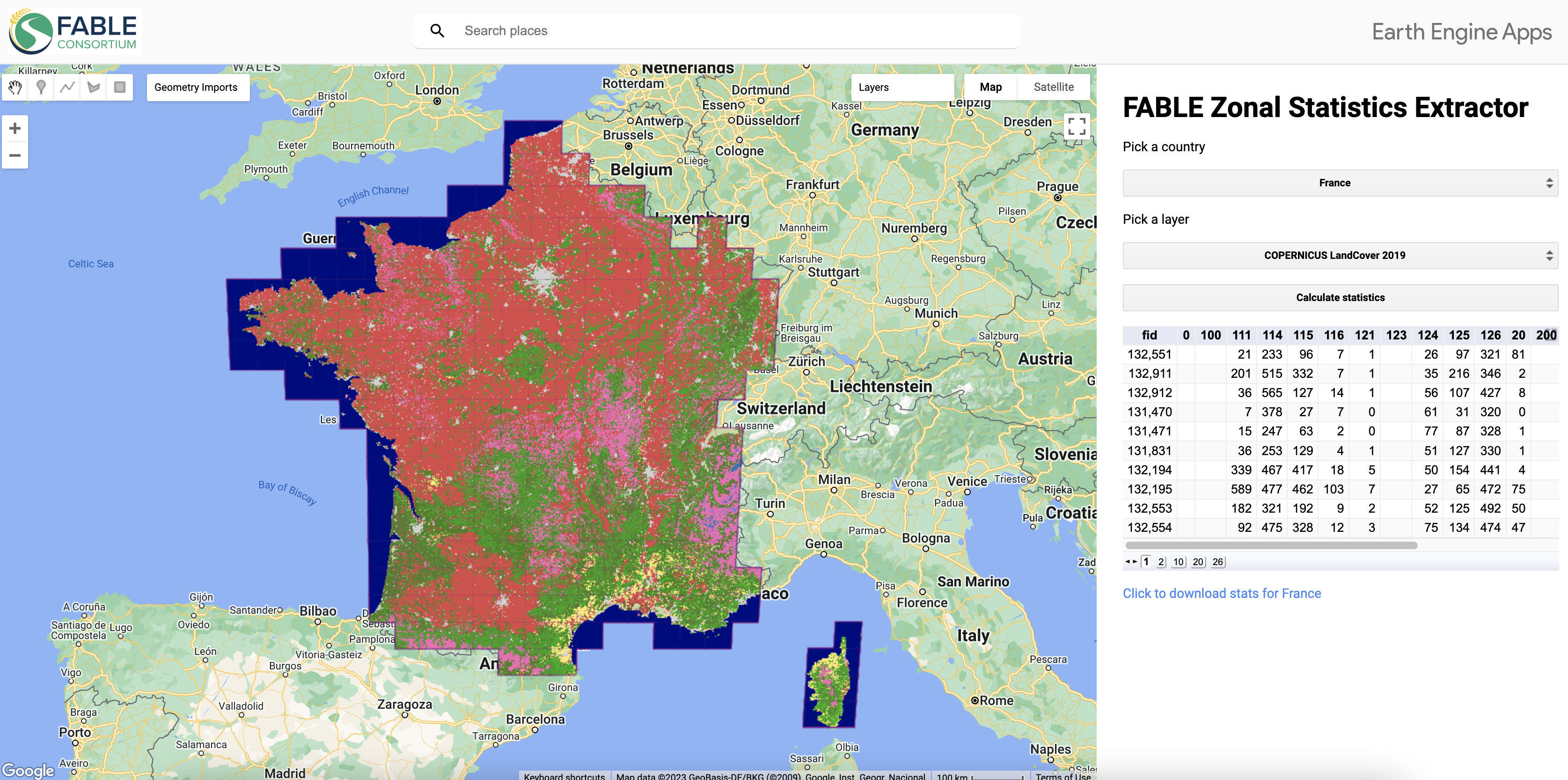
Google Earth Engine App, FABLE Consortium, 2023
Geospatial data science, UNEP, 2022
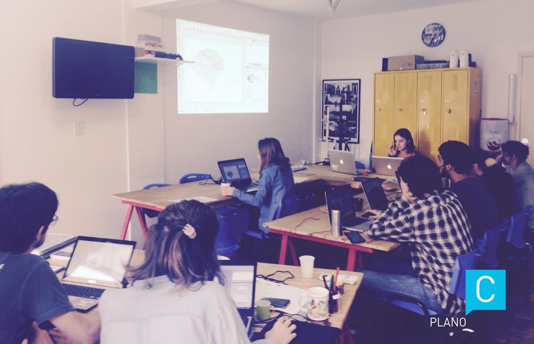
Teaching at Paris Dauphine University, 2018-2023

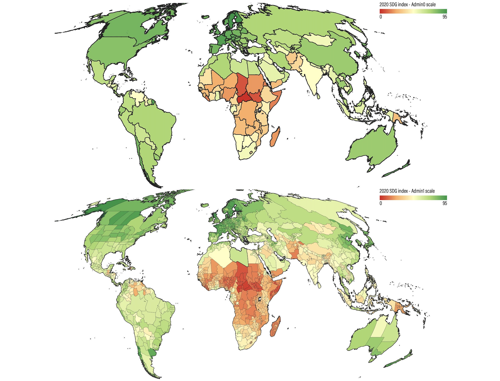
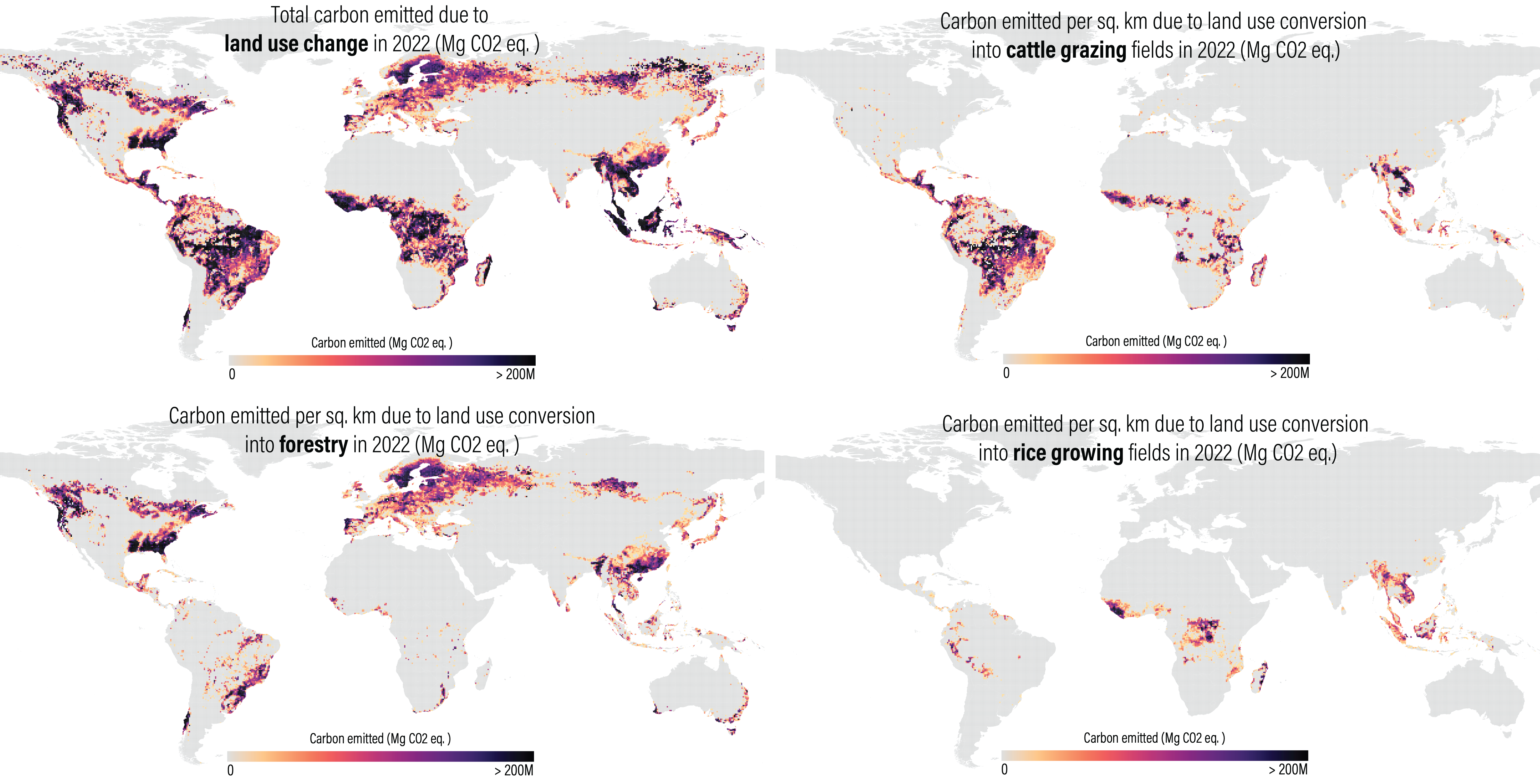
Geospatial indicators for the SDGs, UN SDSN, 2022
Python Brazil Conference 2021
Geospatial indicators for the SDGs, UN SDSN, 2022
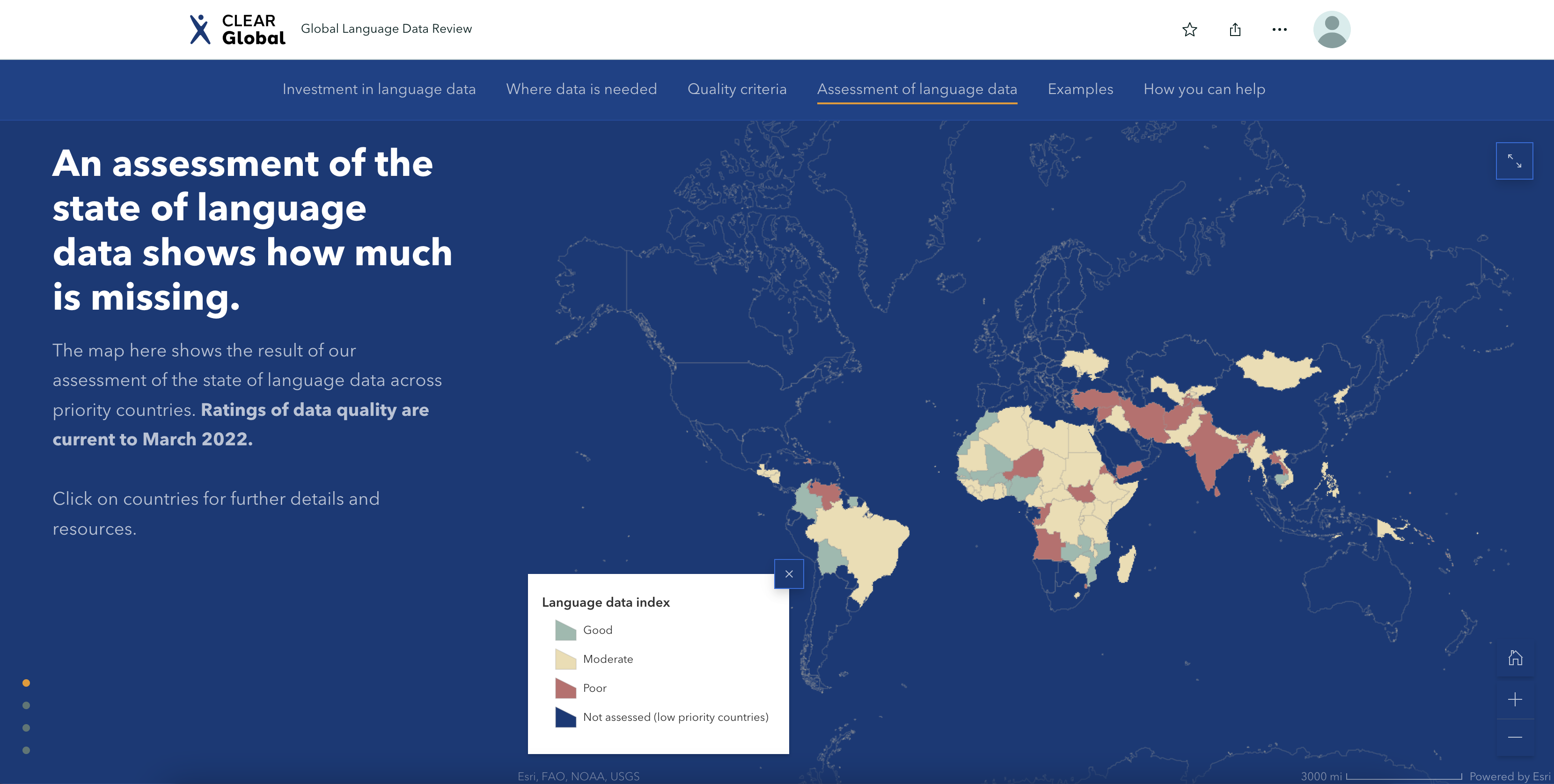
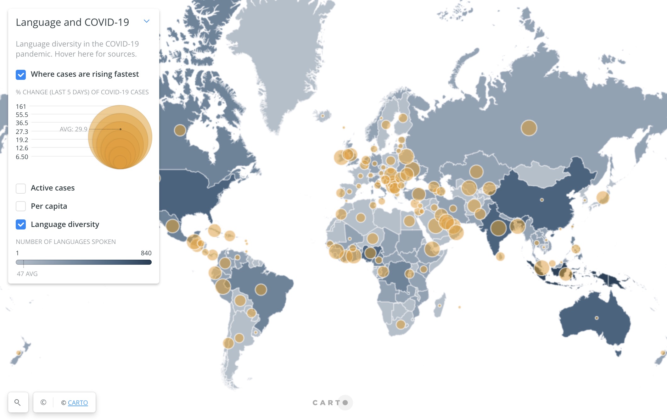
Data curation, data viz, CLEAR Global, 2022
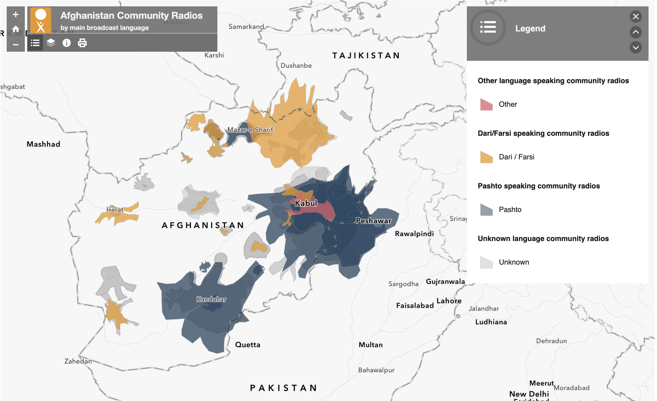
Neural networks, Spatial modeling, CLEAR Global, 2022
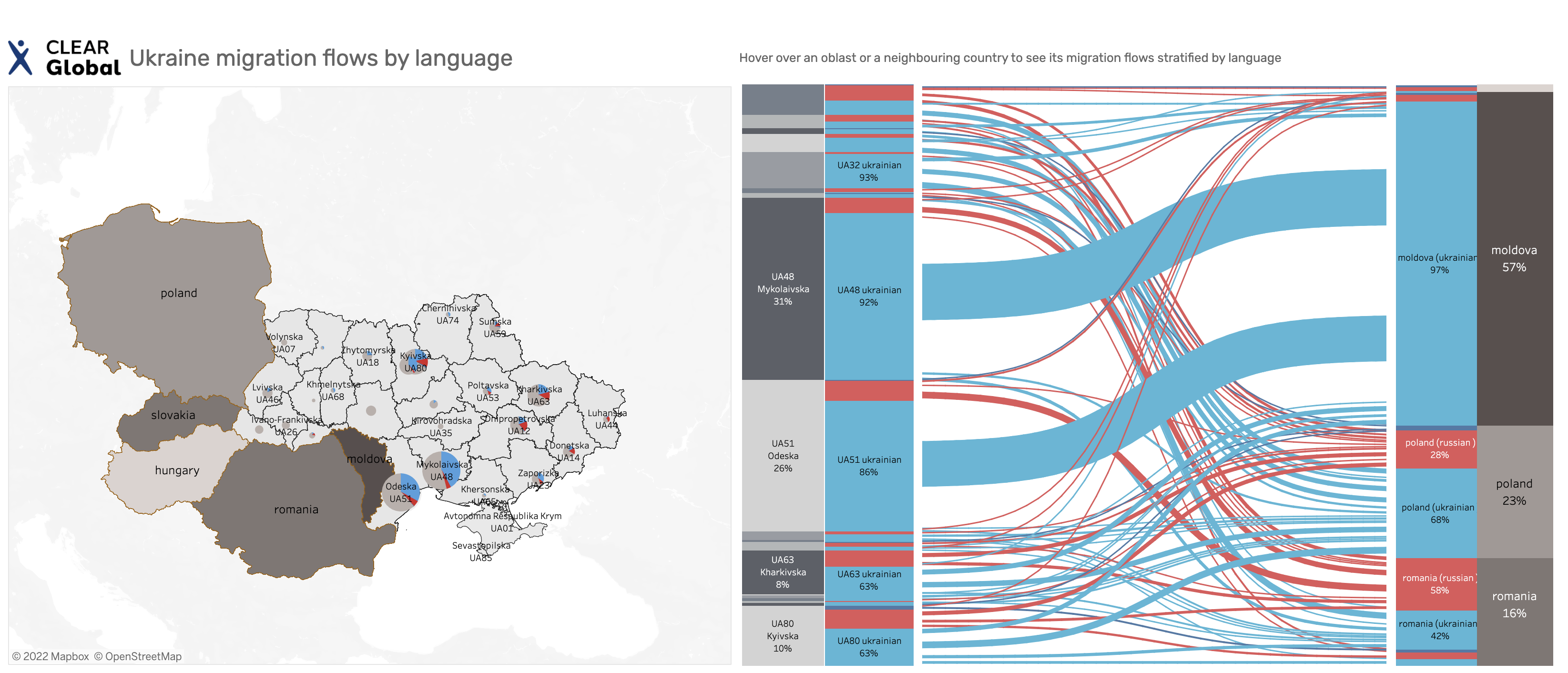
Geospatial data science, CLEAR Global, 2022
Geospatial data science, 2022
Geospatial data science, MaaS Global, 2021
Geospatial data science, WRI, 2022
Geospatial data science, WRI, 2022
Software Development, 2021
Remote sensing script, UNDP, 2018
Software Development, 2020
Software development, 2020
A web map for Translators without Borders, 2020
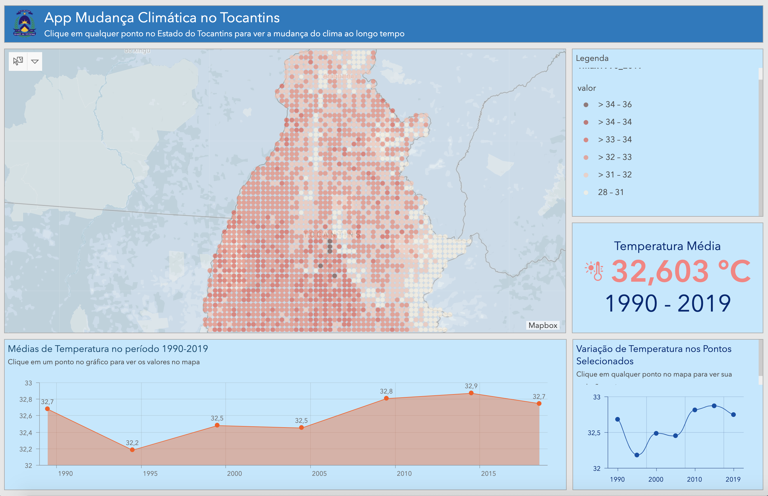
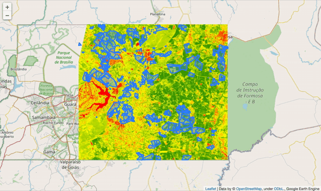
Interactive map application for the State of Tocantins, 2020
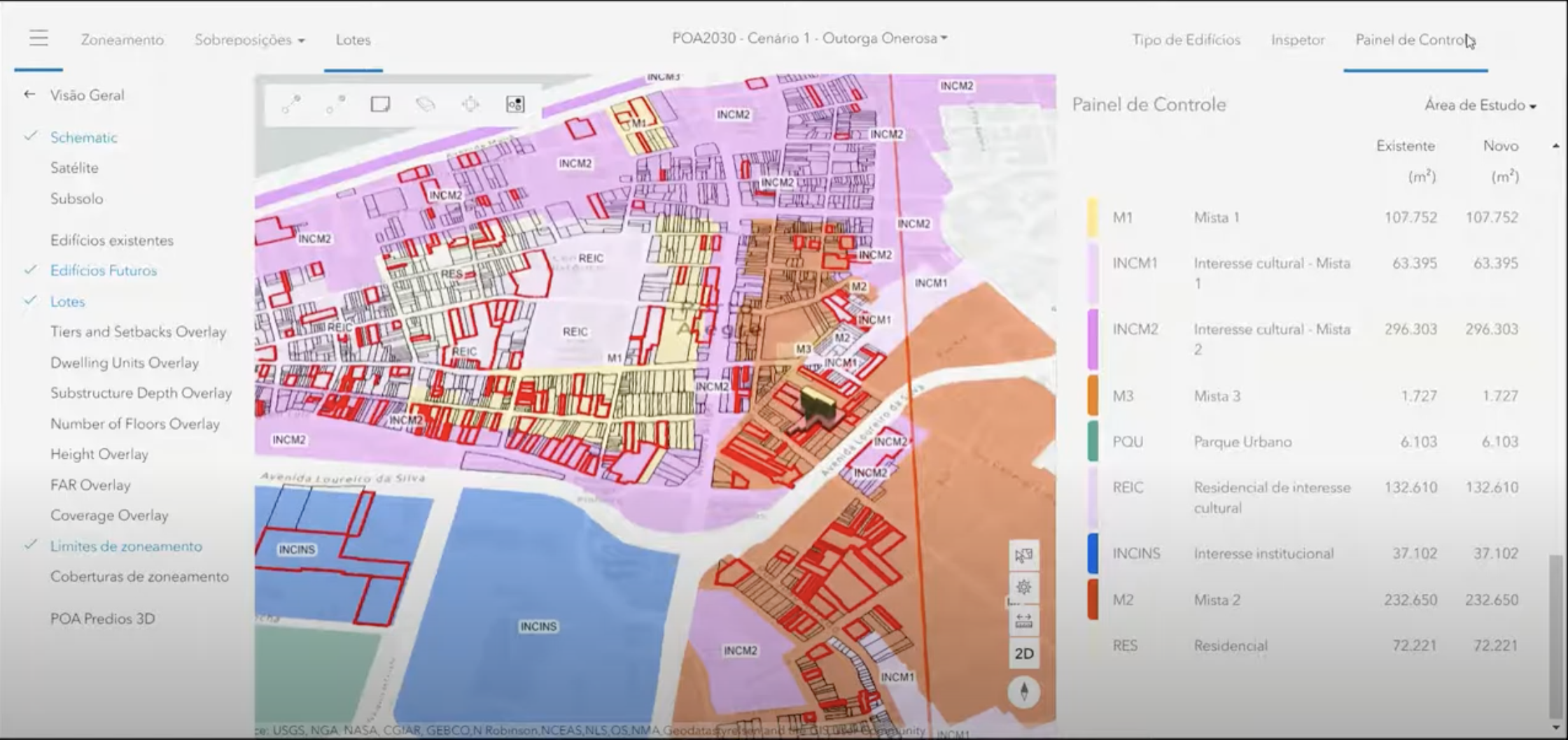
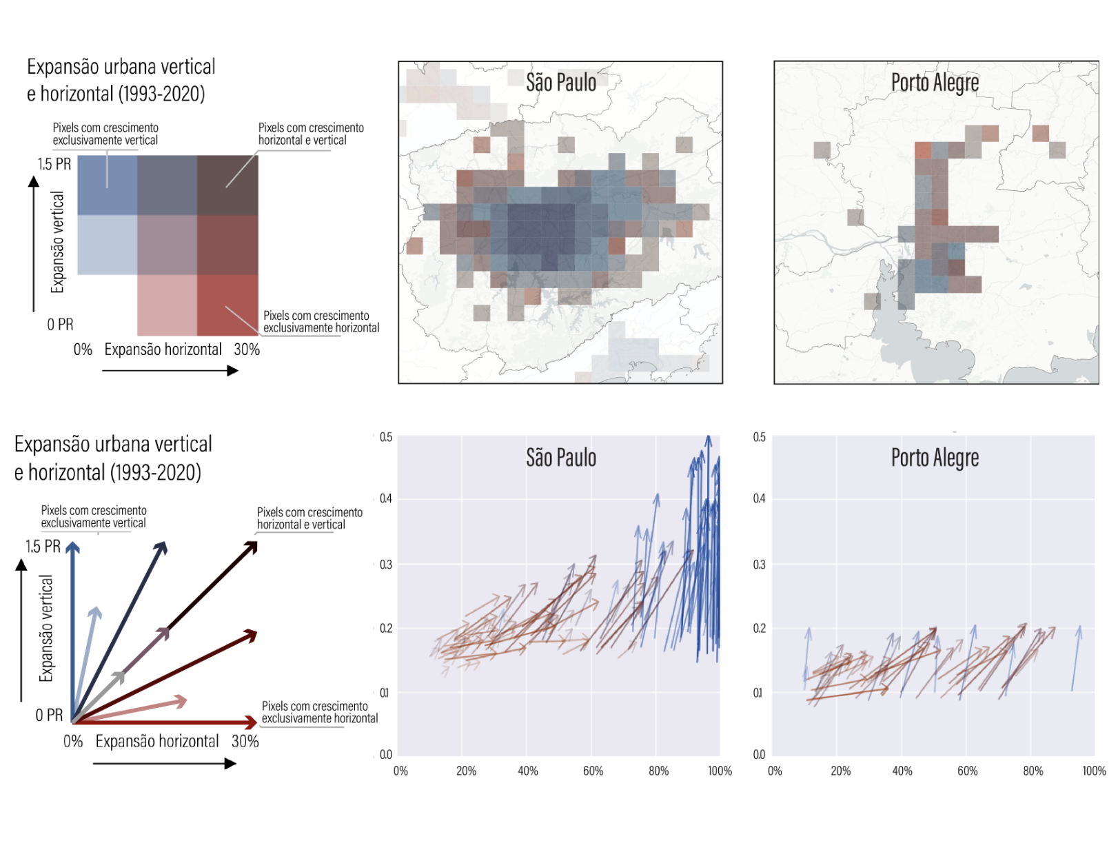
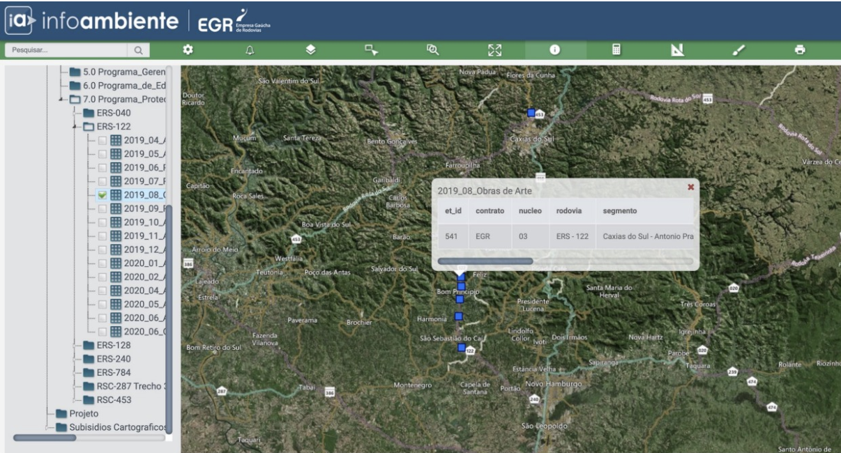
Interactive map application for the Municipality of Porto Alegre, 2019
Interactive map application, 2018
Masters Thesis, 2017
Web map application development, 2017
Article, 2015
Intensive course lecturing, 2016